



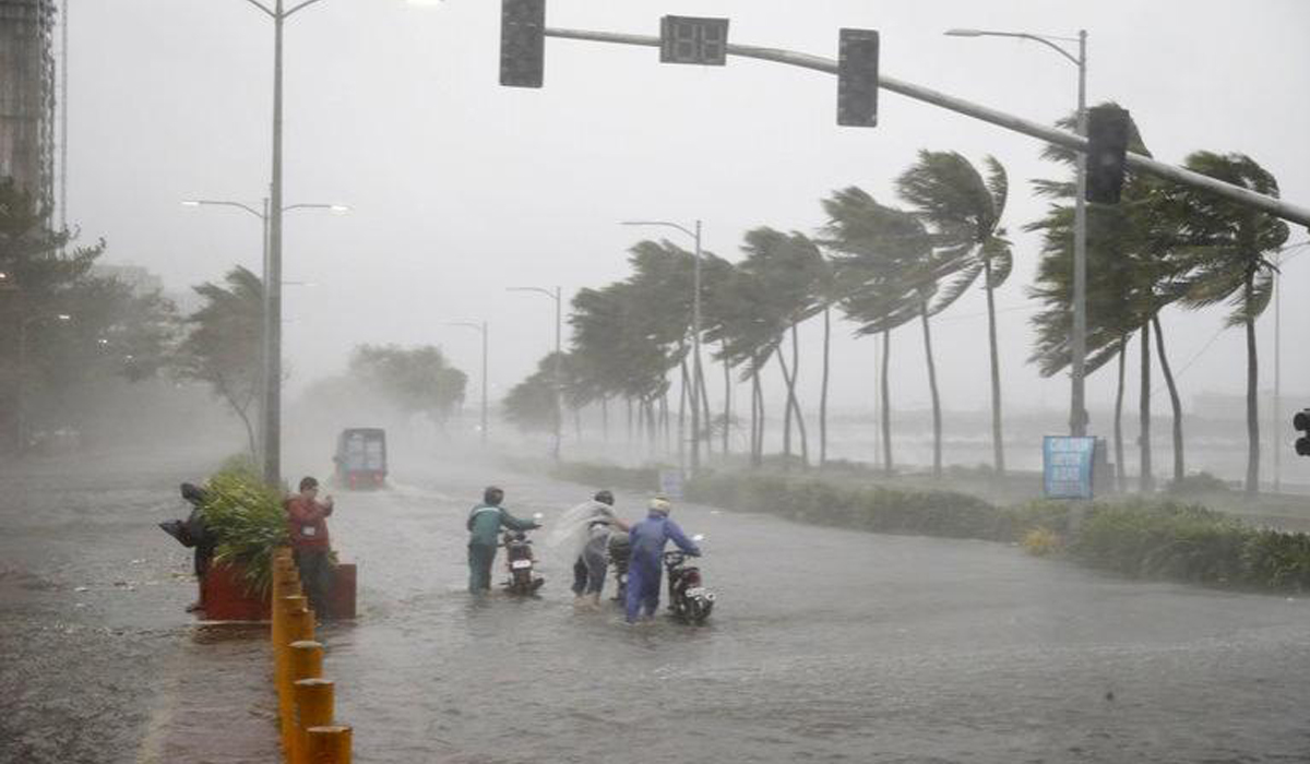
Tropical depression raises coastal hazards as tropical depression emerges
A “low-pressure area” (LPA) over the Philippine Sea has developed into a tropical depression, bringing severe winds and at times heavy downpour in a wide swathe of the country, weathermen said.
Tropical Depression, locally codenamed “Ester”, is not expected to hit land, but it is seen to strengthen — expected to dump heavy rains alongside the southwest monsoon, the Philippine Atmospheric, Geophysical and Astronomical Services Administration (Pagasa) warned Friday.
<blockquote class="twitter-tweet"><p lang="en" dir="ltr">TROPICAL CYCLONE BULLETIN NO. 1<br>Tropical Depression “<a href="https://twitter.com/hashtag/EsterPH?src=hash&ref_src=twsrc%5Etfw">#EsterPH</a>”<br>Issued at 5PM, 29 Jul 2022<br>Valid for broadcast until the next bulletin at 11 PM today<br><br>THE LPA OVER THE PH SEA EAST OF EXTREME NORTHERN LUZON DEVELOPED INTO TROPICAL DEPRESSION “ESTER”<br><br>LINK: <a href="https://t.co/8sFOabzthl">https://t.co/8sFOabzthl</a> <a href="https://t.co/qEQAIWMcSJ">pic.twitter.com/qEQAIWMcSJ</a></p>— PAGASA-DOST (@dost_pagasa) <a href="https://twitter.com/dost_pagasa/status/1552944001107767296?ref_src=twsrc%5Etfw">July 29, 2022</a></blockquote> <script async src="https://platform.twitter.com/widgets.js" charset="utf-8"></script>
The latest weather bulletin predicts heavy rain showers over Southern Luzon, as well as the western and eastern portions of Visayas in the next 24 hours brought by Ester.
Satellite data shows that the “eye” of Ester was estimated at 835 km East of Extreme Northern Luzon, packing maximum winds of 45 kph near the centre and gusts of up to 55 kph.
<blockquote class="twitter-tweet"><p lang="en" dir="ltr">Thunderstorm Advisory No. 16 <a href="https://twitter.com/hashtag/NCR_PRSD?src=hash&ref_src=twsrc%5Etfw">#NCR_PRSD</a><br>Issued at: 9:06 PM,29 July 2022 <a href="https://t.co/qH6nUIUMpp">pic.twitter.com/qH6nUIUMpp</a></p>— PAGASA-DOST (@dost_pagasa) <a href="https://twitter.com/dost_pagasa/status/1553006075993268225?ref_src=twsrc%5Etfw">July 29, 2022</a></blockquote> <script async src="https://platform.twitter.com/widgets.js" charset="utf-8"></script>
Ester is forecast to west-northwestward at 15 kph. As of 2 AM on Saturday (July 30, 2022), Ester is expected to be located at 825 km East Northeast of Extreme Northern Luzon. ??However, the combined effects of the southwest monsoon and the tropical depression will bring light-to-moderate with at times heavy rains, the agency stated.
<blockquote class="twitter-tweet"><p lang="en" dir="ltr">REGIONAL WEATHER FORECAST for <a href="https://twitter.com/hashtag/NCR_PRSD?src=hash&ref_src=twsrc%5Etfw">#NCR_PRSD</a><br>Issued at: 5:00 PM, 29 July 2022<br>Valid Beginning: 5:00 PM today - 5:00 AM tomorrow<a href="https://t.co/ybJTTEOTYf">https://t.co/ybJTTEOTYf</a><br><br>Help us improve our service by answering this quick survey.<br><br>Kindly follow this link: <a href="https://t.co/4NbH7IXvXS">https://t.co/4NbH7IXvXS</a> <a href="https://t.co/PizKKvc3Un">pic.twitter.com/PizKKvc3Un</a></p>— PAGASA-DOST (@dost_pagasa) <a href="https://twitter.com/dost_pagasa/status/1552942566882291718?ref_src=twsrc%5Etfw">July 29, 2022</a></blockquote> <script async src="https://platform.twitter.com/widgets.js" charset="utf-8"></script>
Rough seas
While no tropical cyclone wind signal is currently hoisted for Ester, but weathermen warned that seas will be rough (1.3 to 2.8 m) over the country’s northern and eastern seaboards. Pagasa warned these conditions may be risky for those using small seacrafts.
Mariners are advised to take precautionary measures when venturing out to sea and, if possible, avoid navigating in these conditions.